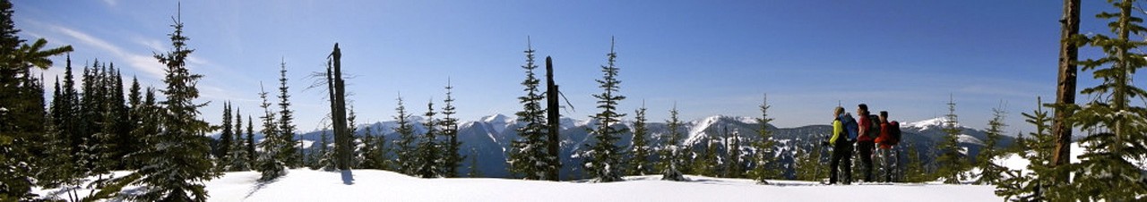

From the trail head, one can hike or ski to the top of Little Bell Mountain, elevation 1980 m (6500 ft), or Big Bell Mountain, elevation 2160 m (7100 ft) to the west. Excellent views of the Cariboo Mountains can be seen to the west and south, the Rockies to the north, and the village of McBride to the east. This is one of the easiest routes to the alpine in the Prince George/McBride areas.
The road access may only be passable to the campsite with a 4WD vehicle. Trail is good to the alpine but unmarked once in the alpine.
From Prince George travel east on Highway 16 for about 198 km. Turn right on Bell Mountain road and travel down this gravel road to you reach an old Forestry campsite (about 14 km, but only the first 7.5 km may be passable to 2 wheel drive cars). From the campsite follow an old road 2.5 km to alpine meadows at about 1800 m.