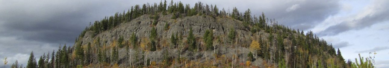

The trail is flagged on the main route which once on top basically follows the rim of what is actually an ancient volcano, and is an easy 2 hour hike with an interesting landscape with evidence of some of the stages of regeneration that has taken place over a wide expanse of time, and has views of the surrounding hills and mountains.
The entire trail was cleared in May 2023
Coffee Pot Mountain is about a 50 minute drive from the Hart Bridge across the Nechako River going north on Highway 97 to the 100 Forest Service Road located across from the Winton Global Mill. It is 9.6 km from this turn-off to Coffee Pot, beginning with crossing the railway tracks then shortly after a bridge over the Crooked River following the 100 Rd for approx 2km then turning left onto the Davie/Crooked FSR, then an almost immediate right onto the 6503 Rd. Follow the 6503 Rd to 6511 where you will turn left onto an old secondary road (there was a small yellow hiker sign nailed to a small tree on the right side in May 2023). Follow this secondary road for approx. 1.5km to a wide spot in the road suitable for parking. The trailhead is marked with another small yellow hiker sign immediately to the left of the start of the route.